The above map has some of its missing pieces added back by using Photoshop and yellow and blue as well.
This is my newest explanation of this map's features based on information I currently found. What I did not know was that on the observe side of this map is important information regarding identification of the map's elements:
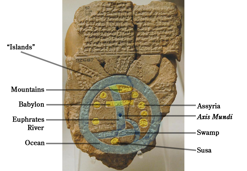
"Islands" - Triangular shapes and are labeled as nagu and may refer to provinces. Some refer to them as mythological objects.
Mountains - At the top are northern mountains and may or not be the Caucasus Mountains.
Babylon - Babylon, the yellow bar shape, did cross the river just as this map indicates.
Euphrates River - Near the bottom of the river is what appears to be tributary which may be the Tigris River. Although not cartographically accurate it would place all the elements of the Babylonian world on one map. The other explanation is that it is the Gulf. There is no identification for what it is.
Ocean - The ocean that surrounds the world. Has been referred to as the cosmic ocean.
Assyria - That's what the map says. That area of text (?) just above is Urartu.
Axis Mundi - My interpretation of this indentation for the center of the world. No comment found.
Swamp - The marshes around the area of Basra
Susa - capitol of Elam.
This map could be the first international map made by the ancients.
Welcome to the
Mesopotamian world view of 600 BC.
 The
Anunnaki
The
Anunnaki